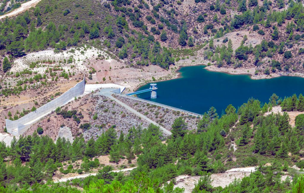
All dams experience seepage to one degree or another.
As seen in the video from the Association of State Dam Safety Officials (ASDSO), primary failure modes in earthen dams are associated with internal piping and seepage under the foundation. Standard geophysical methods typically do not fully penetrate the internal structure of the dam or its foundation.
MERIT has the ability to provide high resolution images of the core and foundation to identify areas of piping and foundation leakage.
Also unlike typical methods, MERIT is a long term solution that, once installed, provides long term monitoring of dam safety conditions.
MERIT can provide long term instrumentation for monitoring the core and foundation of High Risk Dams.
- Aid in risk analysis.
- Provide boundary condition input for modeling.
- Provide imaging of the cutoff wall for quality control.
- Provide detailed profile mapping of bedrock for cutoff wall design.
- Help identify areas of internal erosion inside the dam structure and below the dam foundation.
- Provide detailed 2D and 3D geophysical imaging of inside of the dams as well as below the foundation.

TWO DIFFERENT APPROACHES
Single investigations are less demanding, more flexible, and give our customers one-time geophysical imaging of conditions in their area of concern.
Long term monitoring with permanently installed electrodes answers crucial questions about the condition and safety of the examined embankment dam over time.
HOW IT WORKS

Direct Push In Action
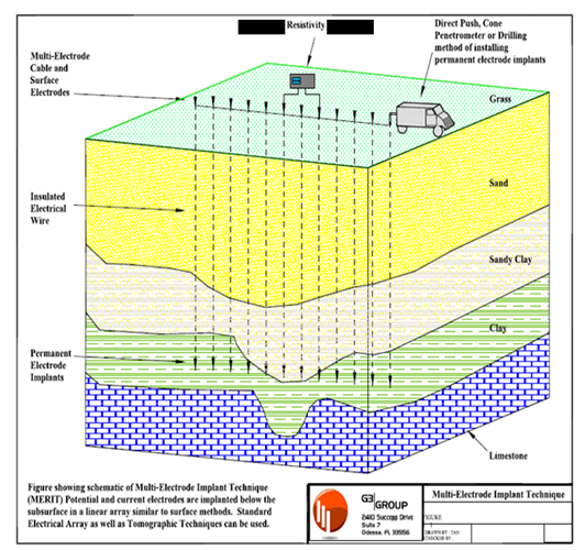
MERIT implants are installed permanently using Direct Push (DP). DP provides a fast and economical technique to install full length geophysical arrays in the subsurface. The installed series of implants act as transmitters and receivers providing deeper energy and detection sources. When combined with surface electrodes MERIT’s tomographic imaging capability is substantially superior to geophysical methods that only use surface sensors as an energy source.
- Implants are introduced into the subsurface in an array intersecting the area of interest.
- The implants are positioned in the subsurface at the elevation so that the electrical fields cover the area of interest.
- Surface electrodes are placed directly above the implanted array.
- Surface and implanted electrodes are connected to standard electrical resistivity geophysical instruments.
- An optimization program is used to collect the geophysical data from the surface electrodes, the lower implanted electrodes, and between the upper and lower electrodes.
- Thousands of data points are collected over a period of hours.
- Data is processed (inverted) using our improved technique.
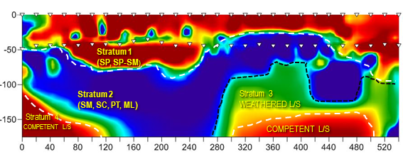
This image shows the result of a MERIT survey. Upper red indicates sand and the blue areas show more conductive areas (clays) , green is weathered limestone and lower red area is competent limestone .
The MERIT technology has the ability to identify and model subsurface geology and geometry with precision. By strategic electrode placement, the MERIT technology can provide more detail than other geophysical methods.

